Discovering Scotland's little towns and villages Part 3
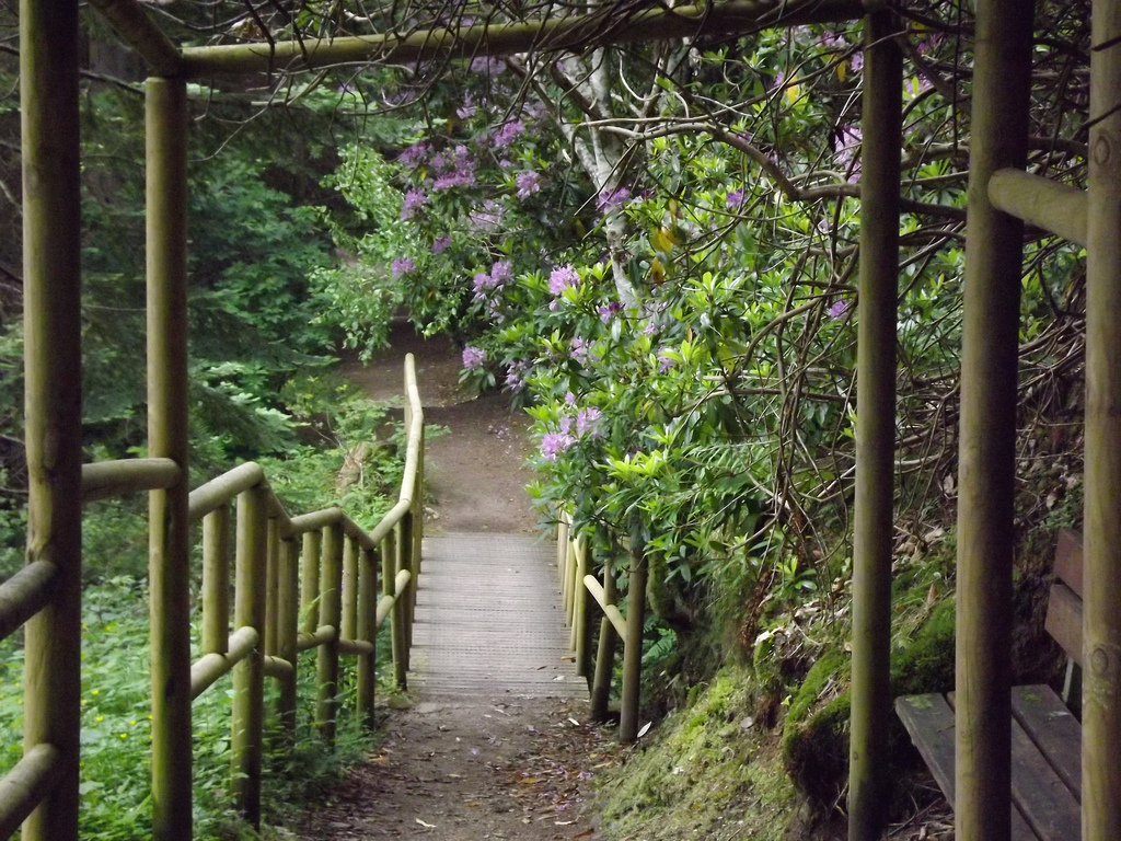
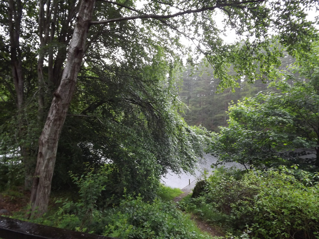
 There is a picnic area and toilets at the start before you go over the wooden bridge
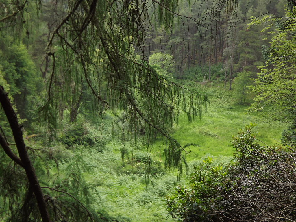
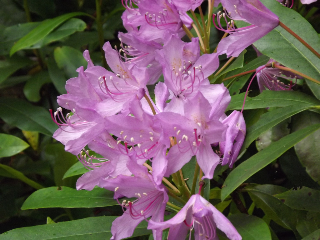
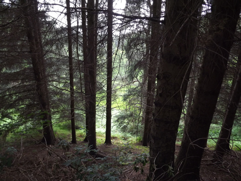
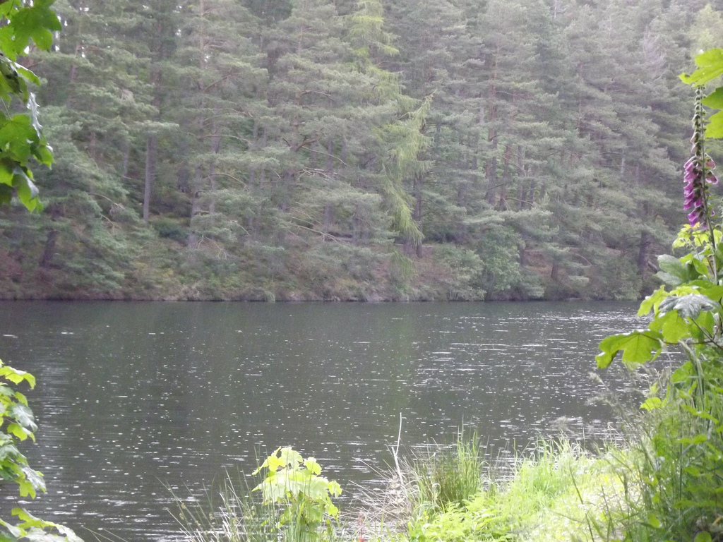
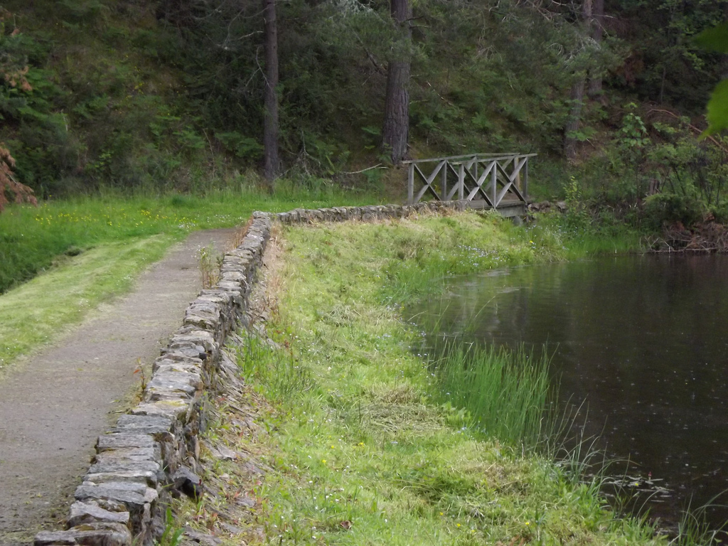
From the car park follow the path next to the information board and soon you are under a tunnel of rhododendron. Cross a bridge and continue through a wide variety of mature trees. The loch here was originally formed by damming local streams to provide a fishing loch and was gifted to the city of Elgin by the landowner and has continued to be improved since then. When the loch is reached continue ahead rather than crossing the dam, soon passing a hut and the fishing boats. Soon the bridge which divides the two areas of this man-made loch can be seen. Head to the left to cross it and on the far side take the path to the right to continue around the far side of the loch through pine trees where red squirrels can sometimes be seen. At the far end steps lead down to the dam, cross the outflow and the dam and keep on the lower path at the water's edge. A small wooded island is passed and then a open shelter which is a good spot to watch the birds on the water. Just before a bench turn right to cross over the middle bridge again to complete the figure of eight walk On the far side turn left and climb through the pines. Where the path forks take the lower path to the left which leads down to a bridge and dam. Cross this and turn right back onto the outward path to return to the car park
0 Comments
Discovering Scotland's little towns and villages Part 2Information care of Wiki
Lossiemouth (Gaelic: Inbhir Losaidh) is a town in Moray, Scotland. Originally the port belonging to Elgin, became an important fishing town. Although there has been over a 1,000 years of settlement in the area, the present day town was formed over the past 250 years and consists of four separate communities that eventually merged into one. From 1890 - 1975 it was a police burgh as Lossiemouth and Branderburgh. Stotfield, the first significant settlement (discounting Kinneddar which has now disappeared), lies to the north west of the town. Next was the Seatown - a small area between the river and the canal inholding of 52 houses, 51 of which are the historic fisher cottages. Following the decision to build a new harbour on the River Lossie, the 18th Century planned town of Lossiemouth, built on a grid system, was established on the low ground below the Coulard Hill. Branderburgh formed the final development during the 19th Century. This part of the town developed entirely as a result of the new harbour with its two basins and eventually covered the entire Coulard Hill and providing the town's impressive profile when seen from afar. Although the Romans never conquered the peoples of the North of Scotland, they made several journeys to the Moray Firth coast. Suspected Roman forts have been discovered at Thomshill, near Elgin and at Easter Galcantray, Cawdor, Nairnshire and also a suspected marching camp at Wester Alves, Moray.[3] The Greco-Roman astronomer and geographer, Claudius Ptolemaeus, generally known as Ptolemy (c. 90 – c. 168), describes in chapter 2 of his Geographa entitled Albion Island of Britannia the mouth of the River Lossie as ostium Loxa Fluvius. Settlement in this area has a long history. St Gervadius, a Celtic hermit inhabited a cave overlooking the entrance to the sea loch, Loch Spynie. In his time, the River Lossie entered the loch further to the south, near Inchbroom. The rocky promontory is recorded in the Chartulary of Moray as Holyman's Head and it is said that Gervadius (St Gerardine as he became known in later times) would walk around the headland with a flaming torch to warn ships away from the dangerous rocks. Even today the Halliman Skerries retain the reference to St Gervadius. He died in 934 AD and his cave became a place of pilgrimage right up to the 16th Century. The cave was eventually quarried out. The settlement at the river mouth is significant particularly in its relationship with the Royal Burgh of Elgin. An argument between Alexander Bur, Bishop of Moray and John Dunbar, 4th Earl of Moray was documented in 1383 regarding the ‘ownership’ of the port of ‘Losey’. This document mentions that Losey was commonly known to fall within the limits of the episcopal estates. The Bishop’s description of the port suggests that it was well downstream from his fishing station at Spynie. It seems likely, therefore to look upon Losey as not merely a fishing station but as a trading port that the Elgin Burgesses used as a counterbalance to the Royal Burgh of Forres's trading port of Findhorn. The dispute with the Earl of Moray went further. That same year of 1383, the Earl wrote to the Elgin burgesses offering them the use of his port at the mouth of the River Spey with no duties in an attempt to take trade from the Bishop. The port and fishery was mentioned again in 1551. Discovering Scotland's little towns and villages Part 1Information care of Wiki.
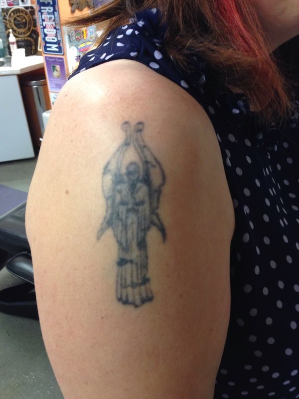
Craigellachie, meaning rocky hill (Gaelic: Creag Eileachaidh) is a small village in Moray, Scotland, at the confluence of the River Spey and River Fiddich (whose valley orglen gives its name to the famous Scotch whisky Glenfiddich), near Aberlour. The village is sited, above the River Spey. Craigellachie dates back to at least 1750, when there was a ferry across the Spey where today's village now stands. It also stands at the intersection of the A95 from Keith to Aberlour and the A941 from Rothes to Dufftown. Craigellachie has two malt whisky distilleries (Craigellachie and The Macallan) and is home to the Speyside Cooperage. Craigellachie Bridge over the River Spey was built by Thomas Telford in 1814. A plaque on one of the castellated towers guarding the entrance to the bridge records that the metalwork was cast in Wales: another that the bridge was restored to this, something like its original condition, in 1964. The bridge is a remarkable piece of engineering, and can be viewed from above or below. Craigellachie is an important stopping off point on the Speyside Way, a long distance path from Buckie in the north to Aviemore in the south. Notable places in Craigellachie include the Fiddichside Inn, Highlander Inn, as well as the Craigellachie Hotel. A notable nearby sight is Balvenie Castle. Many distilleries are in the area, which are part of the Malt Whisket tour. and available for touring, including most notably, The Macallan, Aberlour, Glenfiddich and The Glenlivet. Balvenie Castle is a ruin near Dufftown in the Moray region of Scotland. Originally known as Mortlach, it was built in the 12th century by a branch of the Comyn family (the Black Comyns) and extended and altered in the 15th and 16th centuries. The castle fell out of use in the early 14th century when the Comyns were reduced by Robert the Bruce. Today, the remains of the castle are managed by Historic Scotland; however, ownership continues in private hands. The current owner is Jeremy Duncan Nicholson, Baron of Balvenie, who resides in Atlanta, Georgia in the U.S.A. The castle is open to the public from the beginning of April to the end of September. Balvenie whisky is produced by William Grant & Sons at the Balvenie distillery down the hill from the castle. Many years ago, I had a tattoo that I hated from the very first day (I have to admit, I have many, this is the only one I hated).
  |
AuthorLover of all things horror, writes on the dark-side of life Archives
March 2016
Categories |

 RSS Feed
